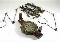
Land surveys consist of six basic tasks: Determinizing your position on Earth using celestial navigation methods Measuring distances with a Gunter’s Chain. Measuring changes in elevation with a Range Pole Measurement of directions and angles using a Compass. Drawing the map on a Plane Table, and Computing areas with basic plane geometry In this series …
Continue reading “How to Survey Land with 18th Century Tools – Measuring Lines”