
Land surveys consist of six basic tasks:
- Determinizing your position on Earth using celestial navigation methods
- Measuring distances with a Gunter’s Chain.
- Measuring changes in elevation with a Range Pole
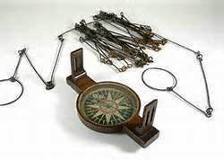
- Measurement of directions and angles using a Compass.
- Drawing the map on a Plane Table, and
- Computing areas with basic plane geometry
In this series we will discuss the fundamentals of doing these tasks in the manner and with tools similar to those available to surveyors in the 18th Century.
Let’s suppose you want to fence part of your acreage maybe section off the back 400 feet for a small cow pasture (in which case your problem is to mark off a line parallel to and 400 feet away from the rear boundary of the property). Or, if your land holding is more extensive, you might want to lay out an area 400 feet by 7,600 feet. In either situation, the main objective is to measure off a specified distance from a known corner point or points.
Place a range pole at the corner from which you want to begin, and set the other pole at an approximation of the desired distance (to help keep you heading in the right direction as you work). Next, recruit the assistance of your team. Stretch the chain to its full length. The person holding the Zero end of the chain is head chainman (HC) and their partner — the surveyor in charge foot end — is rear chainman (RC). One additional surveyor will be in charge of maintaining the line, they are the linesman (LM). The HC marks the starting point with a chaining pin (Use chalk marks instead of chaining pins to mark pavement or other hard surfaces), arms himself with the other 10 pins and walks toward the next corner of the area to be measured. While the HC walks, the LM makes sure a straight path is taken toward the range pole. When the RC reaches the chaining pin, the chain is stretched taught to its full length. At that point the RC yells, “Stick!” and the HC pokes one of his chaining pins into the ground at exactly zero. The pair once again checks to be sure the tape is tightly stretched between them, then the RC picks up the previously dropped pin. The team repeats the whole procedure until the entire distance from corner to corner has been covered. (After 660 feet there should be no pins left, which is a good way to double check against loss of markers).
Basic units of measurement:
- 1 nail = 2¼ inches
- 4 inches= 1 hand
- 1 link = 6 2/3 inches (1/100 Chain)
- 12 inches= 1 foot (3 hands)
- 3 foot = 1 yard (3 feet)
- 6 foot = 1 fathom (6 hands)
- 1 rod = 16 ½ feet (1/4 Chain)
- 4 rods = 1 chain (10 fathoms)
- 10 chains = 1 furlong (660 feet)
- 8 furlongs = 1 statute mile (80 chains = 5280 ft)
- 6080 foot = 1 nautical mile (1 degree of latitude = 6080 ft)
- 1 acre = 10 square Chains (1 chain x 10 chains = 43560 square feet)
Want to Buy Beer from the Colonial Brewmeister?
Help us build a Tavern and Brewery.
Visit our GoFundMe Site
Want the Regimental Brewmeister at your Site or Event?
